
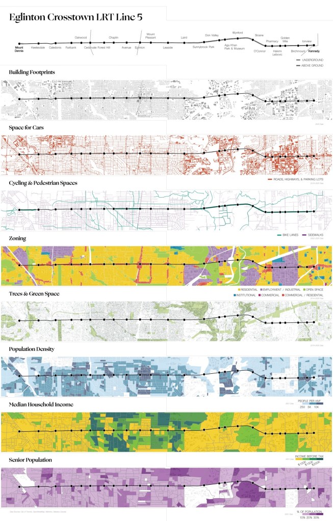
Here is a set of wonderful maps by the School of Cities.
It shows the urban fabric line that the Line 5 Crosstown, Line traverses, featuring the zoning, incomes, green space, room for cars, cycling infrastructure, population density, and age of population.
It is easy to spot the tall rectangle of Eglinton Park, a little to the left of centre.


Leave a comment